

As temperatures rise and heatwaves become more frequent, the City of Florence has expanded its network of “climate refuges” for summer 2026, increasing the number of designated cooling locations from 44 to 53 across the city.
The initiative aims to provide residents and visitors with free public spaces where they can find shade, drinking water and relief from extreme heat. The locations include municipal libraries, parks, gardens and, for the first time, the headquarters of Florence’s five district councils.
City officials say the project is part of a broader strategy to adapt to climate change and protect public health, particularly among older people, those with chronic health conditions and residents who may not have access to cool indoor environments.
What are Florence’s climate refuges?
Climate refuges are publicly accessible places selected according to criteria including shade coverage, access to drinking water, environmental comfort and ease of access.
Most outdoor locations are parks and gardens where tree cover provides at least 70% shade. Indoor refuges include municipal libraries and, this year, district council buildings where visitors can sit indoors and access drinking water during public opening hours.
The city has also introduced dedicated signs that will identify climate refuges on site, in addition to the online map already available through the municipality.
Nine new locations added
The 2026 expansion includes five district council headquarters:
- Palazzo Cocchi Serristori (District 1), Piazza Santa Croce
- Villa Arrivabene (District 2), Piazza Alberti
- Villa di Sorgane (District 3), Via Tagliamento
- Villa Vogel (District 4), Via delle Torri
- Villa Pallini (District 5), Via Baracca
Four additional green areas have also been added:
- Nicholas Green Garden (District 1)
- Former Michelangelo Campsite Park (District 1)
- Piazza Guglielmo Oberdan Garden (District 2)
- Piazza delle Medaglie d’Oro Garden (District 5)
Where can people cool down?
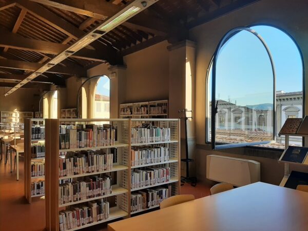
The network includes seven municipal libraries:
- Biblioteca delle Oblate
- Biblioteca Palagio di Parte Guelfa
- Biblioteca Mario Luzi
- Biblioteca del Galluzzo
- BiblioteCaNova Isolotto
- Biblioteca Filippo Buonarroti
- Biblioteca Orticoltura
It also includes dozens of parks and gardens throughout Florence, among them the Cascine Park, Villa Strozzi Park, Villa Fabbricotti Park, Piazza Tasso Garden, the Campo di Marte park area and several neighbourhood green spaces distributed across all five districts.
How to find the nearest refuge
Residents and visitors can consult the city’s interactive online map to locate the closest climate refuge and view information such as:
- shade coverage;
- drinking water fountains;
- nearest entrances;
- seating availability;
- air-conditioned indoor spaces where available.
Why it matters
Heatwaves are becoming one of the most visible effects of climate change in Italian cities. Florence has experienced increasingly hot summers in recent years, with longer periods of high temperatures and tropical nights.
The climate refuge programme complements other measures included in the city’s Green and Open Spaces Plan, such as planting more trees, creating shaded public areas, removing asphalt where possible and using materials that reduce heat absorption.
Practical information
Who can use the refuges?
Anyone. All locations are free and publicly accessible.
When are they available?
Outdoor parks and gardens are accessible according to their normal opening hours. District council offices can be used during public opening hours.
How can I find them?
The complete list and interactive map are available on the City of Florence website under the “Rifugi climatici” section.
For older residents, people with health conditions and anyone struggling with the heat, city officials recommend identifying the nearest climate refuge before the hottest days of summer arrive.
❤️ Support Florence Daily News
If you liked this article, please consider supporting Florence Daily News.
We are an independent news site, free from paywalls and intrusive ads, committed to providing clear and reliable reporting on Florence and Tuscany for everyone.
Your support — whether a one-time gift or a regular contribution — helps us stay independent and keep telling the stories that matter.
Donate securely via Stripe below.
Make a one-time donation
Make a monthly donation
Make a yearly donation
Choose an amount
Or enter a custom amount
Your contribution is appreciated.
Your contribution is appreciated.
Your contribution is appreciated.